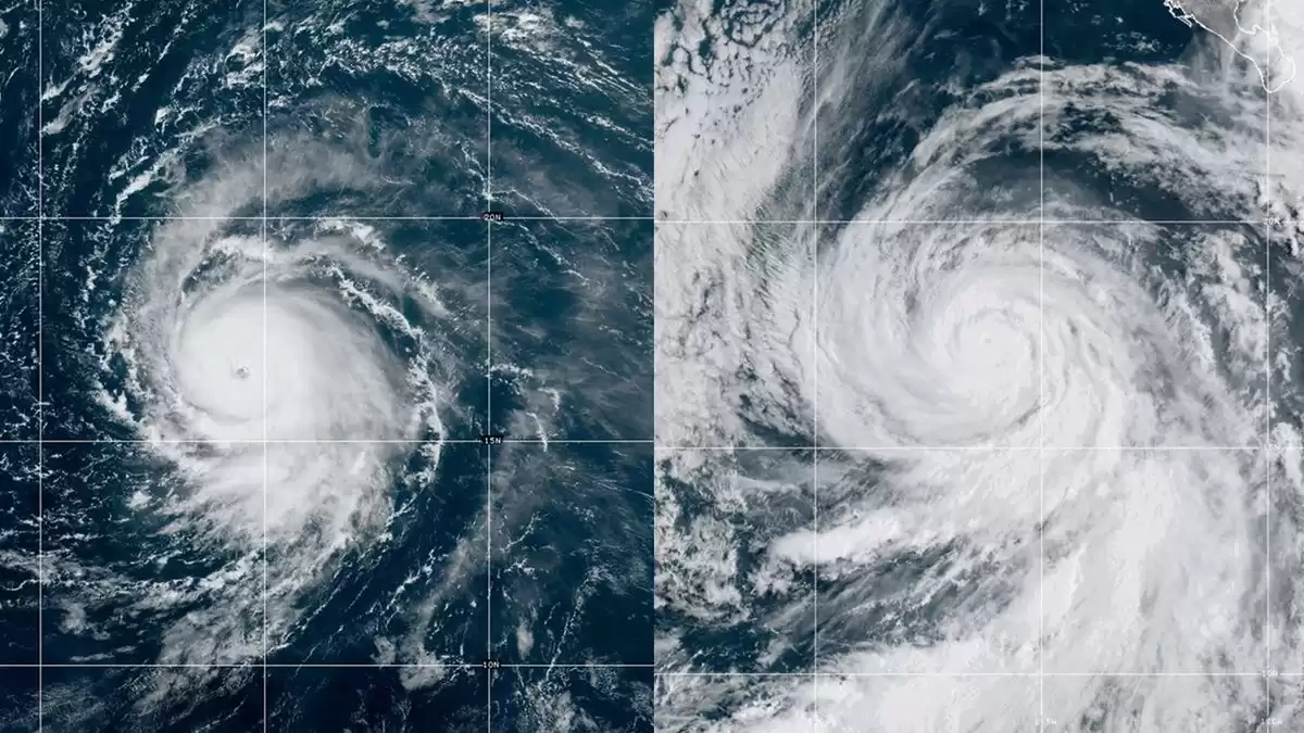
Powerful Hurricane Jova Spotted from Space: Watch Video
The most powerful hurricane of 2023, Jova, is rapidly intensifying in the Pacific Ocean, but fortunately not heading towards the coast. Meanwhile, Hurricane Lee is forming in the Atlantic and poses a threat to several Caribbean islands.
In the year 2023, the Northern Hemisphere has witnessed the rise of a powerful Category 5 storm named Jova. This ferocious hurricane has quickly formed over the warm waters of the Pacific Ocean in less than 48 hours. Despite its rapid intensification, there is some relief as Jova is not heading towards the coast. However, in the Atlantic, another storm named Hurricane Lee has emerged and is expected to bring rough weather to the Caribbean islands later this week.
The astounding development of Jova has caught the attention of meteorologists, who have taken to social media platforms like X (formerly known as Twitter) to share satellite images of the storm. Weather Channel senior meteorologist Jonathan Erdman expressed his awe at Jova's transformation from a tropical depression to a Category 5 hurricane in just over 48 hours. He shared a video showcasing the storm's well-defined eye, which had formed from a seemingly innocent cluster of clouds. This marks the first Category 5 hurricane in the eastern Pacific in almost five years.
According to the National Weather Service San Diego, Jova has become the fastest-intensifying hurricane in the eastern Pacific since 2015's Hurricane Patricia. Within a span of 18 hours, it grew from a Category 1 storm to a Category 5 maelstrom. Jova originated from a low-pressure area off the western coast of Mexico on September 6th and by the following day, it had sustained winds of at least 157 mph (252 kph). Fortunately, the hurricane is currently moving in a northwestern direction, posing no immediate threat to populated areas. However, it is expected to bring rough surf and rip currents to the coasts of Mexico and Southern California.
In contrast, Hurricane Lee has formed in the eastern Caribbean Sea and is predicted to become a potentially devastating Category 5 hurricane by the weekend. Unlike Jova, Lee poses a significant threat to multiple communities. The forecast indicates that it will bring intense rainfall, sea swell, and strong winds to Anguilla, Antigua, Bermuda, the Bahamas, Puerto Rico, and the British and U.S. Virgin Islands.
As the Atlantic hurricane season approaches its peak on September 10th, it has already seen the formation of two major hurricanes: Franklin and Idalia, both of which reached peak intensities as Category 4 storms. In the Pacific, Hurricane Hillary made history as the first tropical storm to hit Southern California in 80 years.
Overall, the emergence of Jova and Hurricane Lee serve as a reminder of the unpredictable and powerful nature of hurricanes. While Jova fortunately veers away from the coast, Lee poses a significant threat to various communities in the Caribbean. As hurricane season continues, it is crucial for residents in vulnerable areas to stay informed and prepared for potential impacts.


Comments on Powerful Hurricane Jova Spotted from Space: Watch Video