When It Rains, It Pours: East Coast Residents Issued Tropical Storm Warning Ahead Of Heavy Weekend Rain
A tropical storm warning has been issued for the East Coast, advising residents to prepare for heavy rain and high winds.
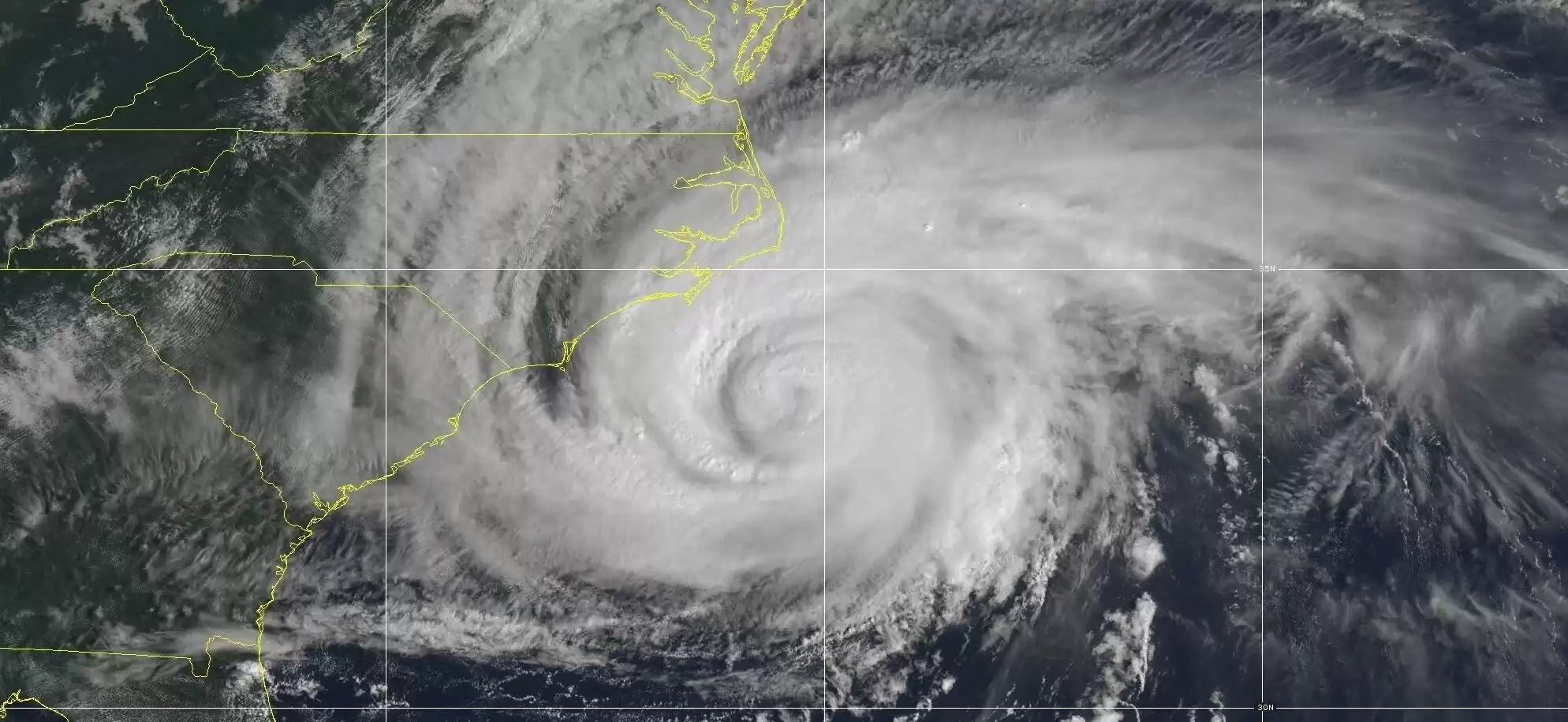
Get ready for heavy rain on the densely populated East Coast in the coming days! The National Hurricane Center issued a tropical storm warning for coastal areas from North Carolina to Delaware as a storm system approaches that could potentially develop into a tropical cyclone. This weather update was released on September 21.
Residents in the path of the storm were advised to prepare for its arrival. The threat is expected to occur between Friday and Saturday, bringing with it high winds and the risk of flooding, as well as the aftermath of distant Hurricane Nigel.
According to the National Hurricane Center, a "Potential Tropical Cyclone Sixteen" has formed approximately 345 miles southeast of Charleston, South Carolina. The storm is moving north at a speed of 8 mph, according to the 5 p.m. advisory from the center.
A potential tropical cyclone is defined as a disturbance that forms within 48 hours and carries the potential for tropical storm or hurricane conditions. This brewing storm could reach the coast of North Carolina on Friday night or early Saturday.
Meteorologist Maria Torres, a public affairs officer with the National Hurricane Center, advised residents along the Atlantic coast to gather supplies and prepare for the storm within the next 24 to 48 hours. Torres emphasized the severity of the storm, stating that it would bring tropical storm force winds, storm surge, and high winds to the East Coast throughout the weekend, particularly in the Southeast and Mid-Atlantic states.
The areas expected to be affected by the potential tropical cyclone stretch from Cape Fear, North Carolina, to Fenwick Island, Delaware. Tropical storm warnings have also been issued for the Chesapeake Bay south of North Beach, Tidal Potomac south of Cobb Island, and the Albemarle and Pamlico Sounds.
Officials from the Virginia emergency management urged residents to prepare for heavy rain, high winds, and flooding in the coming days. The dangers do not end there, as North Carolina Emergency Management revealed that the state's coast would experience large swells caused by distant Hurricane Nigel.
Even before the news of Potential Tropical Cyclone Sixteen, Florida and other East Coast states were bracing themselves for Tropical Storm Lee. The National Hurricane Center warned that Lee could potentially become a hurricane as it strengthened while approaching the coast.
"Lee is not far from hurricane strength, and it likely will achieve that status later today," read the center's 5 a.m. update on September 6. "While it is too soon to determine the location and magnitude of these possible impacts, interests in this area should monitor the progress of Lee and further updates to the forecast."
Reports indicated that Tropical Storm Lee was expected to have maximum sustained winds of 65 mph and was located approximately 1,300 miles east-southeast of the northern Leeward Islands. Rapid intensification, like what Lee experienced, occurs when a storm's winds strengthen quickly over a short period of time. This phenomenon is aided by warm ocean waters. At the time of the report, it was emphasized that if the hurricane stayed at sea, the East Coast could once again face dangerous surf and rip currents.


Comments on When It Rains, It Pours: East Coast Residents Issued Tropical Storm Warning Ahead Of Heavy Weekend Rain