Tropical Storm Harold Hazards in Texas, Millions Impacted by Heat in U.S.
Heat wave with potentially record-breaking temperatures to continue in Central to Southeast U.S. with heat indices reaching 120 degrees.
Get ready for a scorching week ahead as a searing August heat wave shows no signs of letting up. A powerful upper-level ridge situated over the Mid-Mississippi Valley will bring oppressive heat from the Central to Southeast U.S., with high temperatures reaching the upper 90s and low 100s each day. And when you factor in the brutal humidity levels, it could feel like a staggering 120 degrees.
While August often brings dangerous heat, these temperatures are far from normal and are likely to break numerous daily and potentially monthly records. In fact, Iowa and neighboring states could see highs up to 20 degrees above average in the coming days. To make matters worse, overnight temperatures will only drop to the upper 70s and low 80s, compounding the impact of this potentially deadly heat wave.
Heat alerts, including Excessive Heat Warnings, Watches, and Advisories, have been issued across 17 states, from Minneapolis to New Orleans, affecting approximately 150 million people. It is crucial to take this heat seriously and avoid spending extended periods outdoors. These temperatures and heat indices pose a significant health risk and can be potentially deadly, especially for those without proper cooling and hydration.
It's important to remember that heat is the leading cause of weather-related deaths in the United States. So please stay safe and take necessary precautions to protect yourself and others.
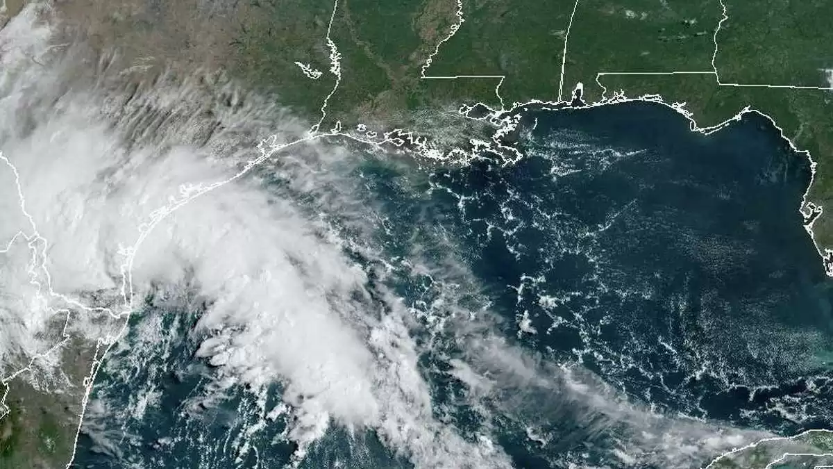
In addition to the scorching heat, Tropical Storm Harold is making its way inland across South Texas. Radar and surface observations show heavy rainfall and gusty winds wrapping around the storm's circulation, leading to flash flood warnings in some areas, particularly around Corpus Christi. The threat of flash and urban flooding will continue in South Texas as Harold tracks into northern Mexico.
As Harold moves further inland, the remnants of the storm and its moisture are expected to push toward the Southwest and Southern Rockies by tomorrow and Thursday. This could bring additional flash flooding concerns, especially near flood-prone slot canyons in Utah, where a Slight Risk is in effect on Thursday.
Meanwhile, the Northern Great Basin and Intermountain West could also experience scattered flash flooding today due to anomalous moisture content and uniform southerly flow supporting potential training showers and thunderstorms.
Looking to the east, precipitation chances will bypass the strong upper high over the Midwest and move from the Great Lakes to the Northeast and Central Appalachians by Wednesday and Thursday. Some of the strongest thunderstorms in these areas could lead to isolated instances of flash flooding, damaging wind gusts, and severe hail.
While the West and Northeast will see below-average temperatures accompanied by rain chances and clouds, with highs remaining in the 70s and low 80s for most locations.
So stay prepared for the extreme heat and potential weather hazards in your area. Stay cool, stay hydrated, and stay safe.


Comments on Tropical Storm Harold Hazards in Texas, Millions Impacted by Heat in U.S.