Hurricane Beryl Category 3 Caribbean
Hurricane Beryl forms in Atlantic, expected to hit Caribbean. Rare early season storm intensifying quickly, potential impact on Gulf Coast uncertain.
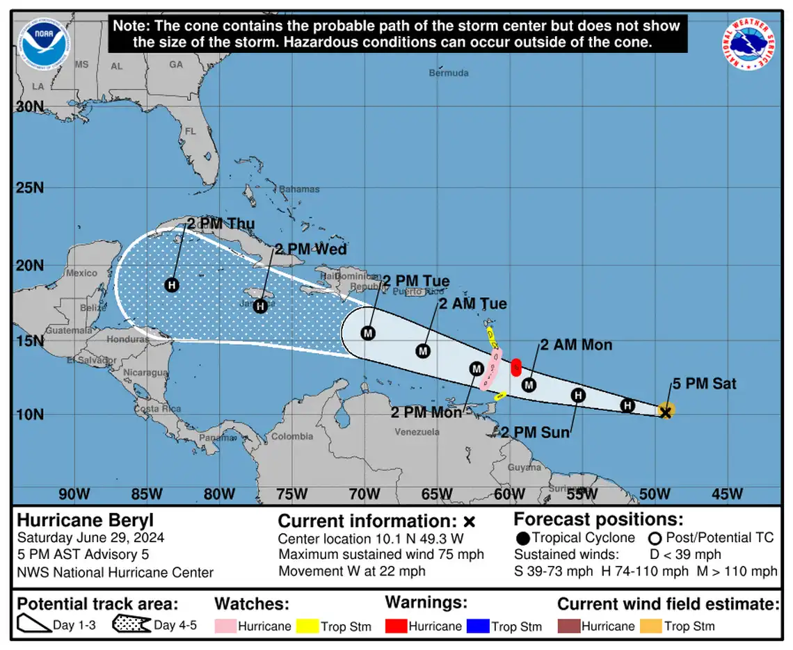
The National Hurricane Center has identified the first hurricane of the season, named Hurricane Beryl, forming in the Atlantic. This dangerous storm is expected to strengthen rapidly and make its way towards the Caribbean, impacting the Windward Islands with hurricane-force winds and storm surge. The Weather Channel predicts that Beryl could reach Category 3 status once it hits the Windward Islands.
Although Hurricane Beryl is currently moving west towards the Gulf of Mexico, it is still too early to determine its exact path. This early formation of a hurricane in the season is quite unusual, with meteorologists noting that Beryl is the first storm in over 90 years to reach so far east in June. Typically, the first hurricane of the season does not occur until around August 11.
Forecasters are closely monitoring Beryl's movement, predicting that it will enter the eastern Caribbean Sea on Monday before tracking west-northwest towards the Gulf of Mexico. However, it is uncertain whether Beryl will pose a threat to the U.S. Gulf Coast.
In addition to Hurricane Beryl, the National Hurricane Center is keeping an eye on two other systems in the Gulf of Mexico and the Atlantic. One area of low pressure and thunderstorms in the Atlantic has a 70 percent chance of development within the week, while there is a 50 percent chance of a tropical depression forming near Mexico. These systems are not expected to impact South Mississippi immediately.
Overall, the early formation of Hurricane Beryl and the potential development of other systems serve as a reminder of the unpredictability of weather patterns. It is essential for residents in hurricane-prone areas to stay informed and prepared throughout the season.


Comments on Hurricane Beryl Category 3 Caribbean