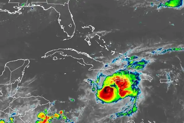
Hurricane Beryl threatens Jamaica and Caymans with 145 mph winds
Hurricane Beryl, a Category 4 storm, approaches Jamaica with 145 mph winds. Major impacts expected, including storm surge and heavy rain.
Hurricane Beryl maintained its dangerous Category 4 status as it made its way towards Jamaica, with the National Hurricane Center issuing warnings for various regions in the Caribbean. The storm, with sustained winds of 145 mph, was located around 185 miles east-southeast of Kingston, Jamaica, and moving swiftly west-northwest at 20 mph. The hurricane was expected to pass near or over Jamaica before moving towards the Cayman Islands and the Yucatan Peninsula.
Beryl had previously hit the Windward Islands, making landfall on Grenada's Carriacou Island as a Category 4 hurricane before intensifying to a Category 5 storm. This made it the earliest recorded Category 5 hurricane in history, attributed to high ocean heat content levels in the Caribbean. The storm was forecasted to weaken slightly but remain a major hurricane as it approached Jamaica and the Cayman Islands.
The NHC also monitored a tropical wave east of the Windward Islands, with a low chance of formation in the next few days. Regardless of development, gusty winds and heavy rainfall were expected in the Lesser Antilles. The Atlantic hurricane season was predicted to be above average, with NOAA forecasting 17 to 25 named storms, eight to 13 hurricanes, and four to seven major hurricanes. The first named storm of the season, Tropical Storm Alberto, formed in June, with the peak of hurricane season expected from mid-August to October.


Comments on Hurricane Beryl threatens Jamaica and Caymans with 145 mph winds